[outdoor in Switzerland] hiking in Jungfrau: it's worth being a dog to see the beauty of God's back garden
Days: 5 days
Time: June
Per capita: 3000 yuan
With whom: one person
Play: photography, free walking, hiking
The author went to these places
Jungfrau
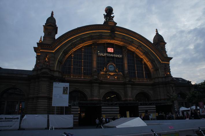
Interlaken
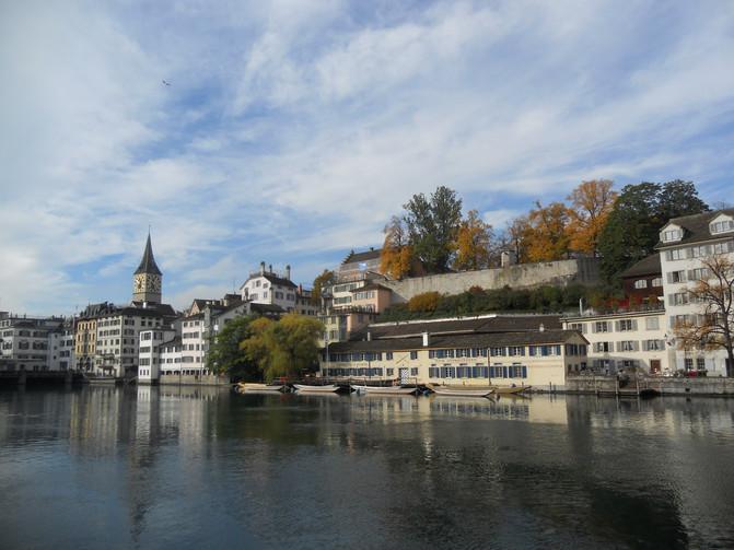
Geneva
Small Separation
Lauterbrunnen
Stechelberg.
Wengen
Gimmelwald
Schilthorn
Switzerland
Wildwell
Rugenpark B amp; B
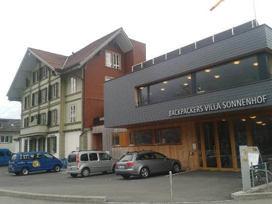
Backpacker Villa
Recommended accommodation
Backpackers villa Sonnenhof - Hostel Interlaken ¥ 924, book now >
Launch more hotels
Published on August 10, 2014 19:19
preface:
Probably because of time, most domestic tourists go to Jungfrau by train to the top of Europe and then leave in a hurry. Few people stay three or four days or more. In fact, Jungfrau is a paradise for outdoor sports, extreme sports, skiing and hiking. Especially for hiking. Open the hiking map provided by the tourist information office, there are more than 60 routes, and most of them are suitable for ordinary tourists. I looked at the map, as long as it's not snow mountain, you can walk.
On the first day when I arrived at Interlaken, it rained. On the second day, it rained. On the third day, it snowed. In June, it snowed. It was a graduation trip. I thought that I would not have the opportunity to play in such an open way regardless of the time cost for a long time. So I withdrew my ticket from Geneva to England. I decided to wait until it was fine in Interlaken, At that time, I had a feeling that I couldn't see the snow mountain and didn't leave. It turns out to be wise.
Background:
The scenic spots, place names, towns and routes in Jungfrau are very complicated and messy. If there is no map in advance, it is difficult to imagine what the actual situation is just by looking at the text explanation. Download a map in advance and study it. It's very helpful to make travel plans. See the official website of Jungfrau for details http://www.jungfrau.ch/
Interlaken is the gateway to the Jungfrau region. Then, to the south, the whole mountain area is divided into two valleys. To the East is the Grindelwald gorge. You can drive from Interlaken to the town of Grindelwald in the gorge by car. It's a big tourist center with hotels, restaurants and shops. From Grindelwald, you can take a cable car to first peak in the north and M & auml in the West; You can also take the train route Kleine Scheidegg to the top of Europe, the highest railway station of Jungfrau. You can also take the bus to the east to see the blue glacier.
To the west is Lauterbrunnen Gorge (north-south, Lauterbrunnen town to the north and stechelberg village to the South). Self driving can take you from Interlaken to Lauterbrunnen, then south to stechelberg village at most. Lauterbrunnen is a transit station. Here you can continue to take the train east to Wengen. Wengen is a small car free town in the middle of the mountain. It's very busy, with accommodation, restaurants and shops. From Wengen, you can take the train to Kleine Scheidegg to the top of Europe; You can also take a cable car east to M & auml; Nnlichen peak.
From Lauterbrunnen to the southwest by train, you can get to another car free town, m ü rren, which is actually not a small town. Quite a number of tourists choose to live here. From m ü rren, you can take the cable car up to the Schilthorn peak of Pat 007, so you can take the cable car down to gimmelwald to stechelberg village.
In the middle of the two canyons is not very high M & auml; Nnlichen peak (2227m) and Kleine Scheidegg peak (2061). To the south of the two valleys are the snow mountains, the most famous of which is Eiger peak (3970m), M & ouml; It is found that there are two peaks, Shangfeng (4107 m) and Jungfrau Jungfrau (4158 m).
Route:
This time, some routes are difficult, not suitable for all ages, but also a little risky. Moreover, the season is very important for walking in the mountains. There is still a lot of snow at the end of May. For the same route, you can walk very freely in August.
DAY 1
Lauterbrunnen - Grotschalp - Allmendhubel - Birg - Shilthorn - Gimmelwald - Stechelberg - Lauterbrunnen -24466; - 27493greenholp - Allmendhubel - Birg - Shilthorn 7 hours + Stechelberg - Lauterbrunnen 1.5 hour
DAY 2
Lauterbrunnen - Wengen - Jungfraujoch - Kleine Scheidegg - Wengen - Lauterbrunnen ★ hiking section: Kleine Scheidegg - Wengen - Lauterbrunnen
DAY 3
【schynige platte - first瑞士最佳观光线】Wilderswil- Schynige platte - Faulhorn - bachalpsee - First - Grindlewald - Interlaken Ost★ 徒步段:Schynige platte - Faulhorn - bachalpsee - First
get accommodation:
Backpacker Villa
Interlaken's famous hostel must be ordered as early as possible (it's better to book it a month before the peak season in summer). Although I live in a double room (98 Swiss Lang, www.villa. CH), the sanitation and shower are public. The sheets, quilt covers and pillowcases should be made by themselves from the front desk. But the hotel is really clean, and there are three computers with internet access, and a kitchen where you can cook by yourself. In addition, free breakfast (very simple kind), free WiFi, free local bus day, free postcard, free commemorative ballpoint pen. There are a lot of Korean people, and more than half of the guests are young Korean. Even the registration card is bilingual in English and Korean.
B&B Rugenpark
I made a reservation on hostelbookers.com. It's a family hotel run by a couple. About 70 euro a night, double room, public health and shower. The hardware condition is not as good as that of backpacker villa, and the public health and shower areas are very crowded. High power appliances are not allowed in the room. But breakfast was pretty good. The landlady is very emotional. There are many Oriental artworks in the hotel, as well as welcome drink, biscuits and making tea for breakfast.
Above, above
DAY 1
On the first day, there are actually three hiking lines: the panoramic line of the mountain peak, the climbing line of Xuelang peak, and the waterfall line at the foot of the mountain. Pink is the cable car line, red is the hiking line. There are three routes for hiking, and there are marked numbers on the routes. Before I set out, countless people warned me not to climb Xuelang peak, and recommended route 1, a beautiful panoramic line of mountain scenery. Along the way, I could see three peaks of egger, monks and girls, as well as other nearby peaks. The montain trail I took was a little difficult. Also, from gr ü tschalp - Allmendhubel to Murren, there is a real flower and grass line a little lower, which runs through the forest without climbing. Many old people are walking. From Lauterbrunnen to gr ü tschalp, about half of the people choose to take a small train to Murren; Among the people who came out for hiking, only three chose to take the panoramic line of mountain scenery, and the rest all went to the flower line. Although the mountain panoramic line is more difficult, the index is higher because it faces the snow mountain and is not covered by trees.
Wait until the bifurcation point, hesitated for a moment, along the peak road forward. It's line 2 of the day. It's a very difficult period. I've played the drums for countless times. Countless people suggested that I should not go. Every time I was suggested, I would hesitate. I also pointed out the panoramic line of birds singing and flowers smelling, seeing the panoramic view of snow mountain and walking along the hillside. It was precisely because the panoramic line of nearly three hours wasted a lot of physical strength.
Later, when I got down again and took the cable car, the person driving the cable car told me that I had taken the wrong road. I told him that there was no footprints on the right road and I couldn't judge at all. He said that this season is not the season for climbing snow, so the whole road is closed. When the snow line is very high in August, you can basically walk all the way up. Looking at the road on the cable car, I can't help but wonder how I can walk through such a place.
The ambition of temporary conquest is in a strong position, and from the map, there are relay stations that can rest or even take the transition cable car to the main cable car, although each relay station is more than an hour away. The slope of the mountain road is very steep. I feel tired after less than an hour. I can't find the road or the sign when it is covered with snow. I can't see the top at this time. I find the way with my weak sense of direction. However, when I got to the relay station, I found that there was no one on the wasteland, the lonely cable station and the wooden house door were locked, and the endless snow on the wasteland strongly challenged my determination. However, it's not too late to set a deadline and start moving forward. I want to swear that I will never walk on snow again. I suddenly remembered that I had vowed never to climb Huashan again, but later I didn't go. If I mention it later, I will probably go again.
If you are not careful, you will step on the ice and sink into the stream below; Or a foot down, half a leg into the number of gradually increasing. Shout to the mountain, sneer at his poor ambition and adventure. Climb again, finally see the peak, no longer despair, not only because of numbness and disappeared, or really because of the dawn, or both, the rest is just gone. The footprints along the way also gave a lot of strength. The mountain road is still steep, with hands and feet.
After a lot of hard work, I arrived at 007 restaurant and sat down to drink the recommended Alps wine to warm my stomach. I really have mixed feelings~
DAY 2
For the sake of accuracy, I confirmed my route, so I went to the official website for an online search. However, the titles of the tracking trail on the official website were all numbered numbers, and there was no preview or place name prompt. I had to click one by one to see which route I was going through... The reason why I was so careful was that the road I was going through on this day was two sections of tracks, which met in Wengen. The last section is the scenery of snow mountain. From the trend of the route, we can see that the upper section faces the snow mountain with a good perspective, which is also highly recommended by the tourist center. This section is generally called alpine vegetation line. It's my name, Khan... Because I saw an advertisement saying that I saw snow and tundra on the mountain, followed by grassland, forest, waterfall and Mediterranean terraces. It's true to observe this vegetation change along the way. It's the pride of Jungfrau. So why not take the opportunity to enjoy it.
1.Walk from the snow mountain and the wilderness to the coniferous forest. 2. Rest on the hiking road. The red chair is very attractive. 3. Broad leaved forest. There are many cattle bells around Wengen. There must be grassland nearby. 4. There are streams. It's almost to Lauterbrunnen
DAY 3
According to the information provided by the Swiss panoramic hiking website, this route is 16 kilometers long, with a rise of 1040 meters and a fall of 863 meters. It is difficult to do so. Many of the sections are rocky or rippling areas, which require certain experience and good physical strength. There should be antiskid mountaineering shoes, windbreaker and daily provisions. It takes about 6 hours for an experienced person to complete the whole process. Normally, it takes 6-7 hours. It is generally recommended that this route should be taken from July to October. Tearful thing is that our day is the second day of the opening of schynigge Platte, which is the earliest season for the opening of this route. Most of the way is through the snow. Back to compare other people's travel notes and photos, we found that the so-called rocky area is endless snow when we walk.
1.Starting from wilderswil, sitting on the wooden chair of the "historical" climbing gear train, it took nearly an hour to get to schnigge Platte. At the middle stop, the old steward grows a big beard in the Alps. It's probably intentional. After all, one of the selling points of this climbing car is "historical folk custom", The grassland and small stone hill like the scenery in the game 3. Looking up, the classic nestles of the three peaks of egger, monk and maiden 4. Looking down slightly, the landscape at this time still belongs to grassland 5. This botanical garden with a high mountain, selling point is the botanical garden of the whole natural environment, excellent plant study base. The picture is a lovely marmot in the entrance shop of the botanical garden. It's only 10chf, but I didn't buy it at that time. I regretted it for a long time... I didn't find it again, so I had to buy a bunch of bears for my friends. It should be known that almost every city in Europe has its own story about bears. Every city has city bears for sale. Although the colors of bears wearing the Swiss flag are very beautiful, I still can't help but miss this groundhog
Last part:
It's worth it to be a dog... After watching the snow mountain in Switzerland, I feel that I'm going to lose my pursuit
Xiangdong Lai